Availability: 1 in stock
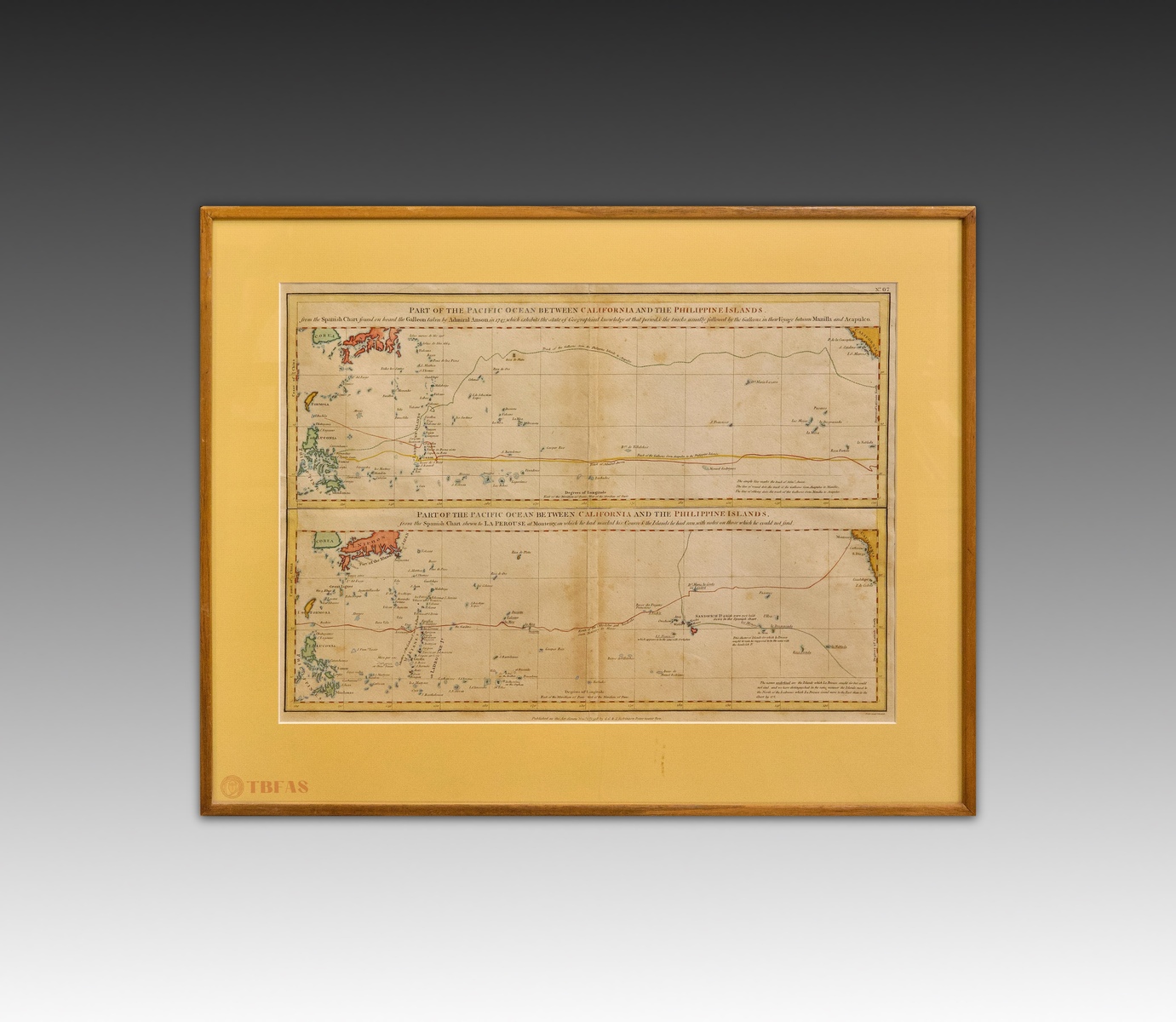
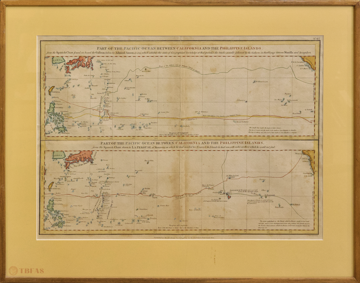
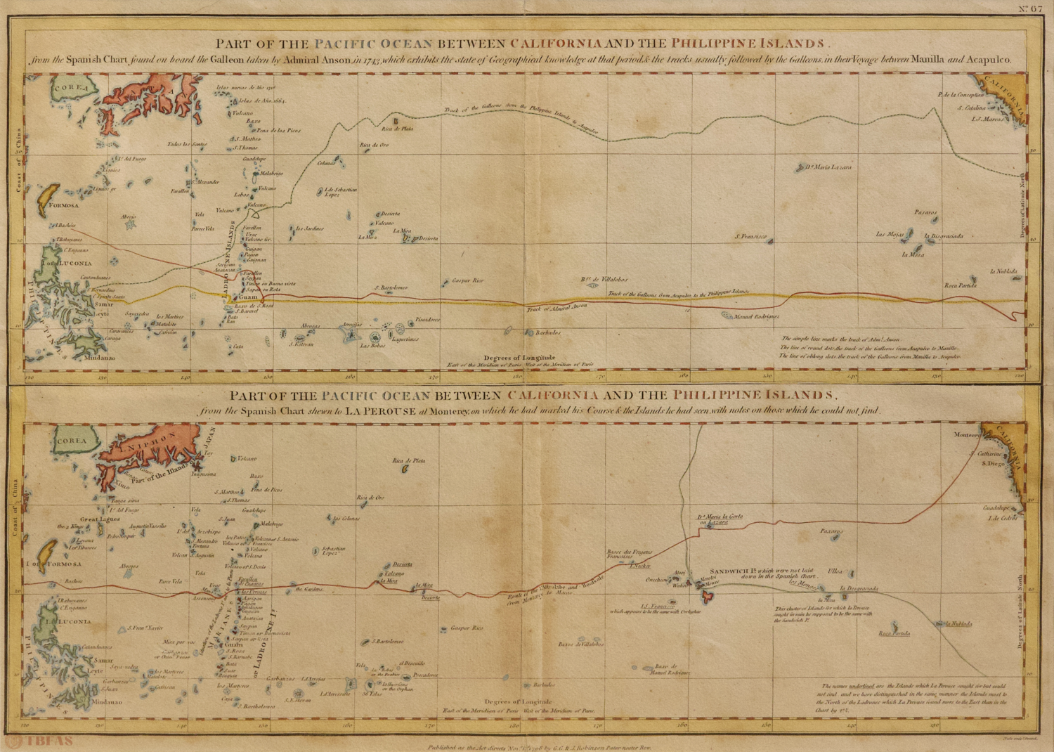
Part of the Pacific Ocean Between California and the Philippine Islands
$900.00
| Item # | |
|---|---|
| ag_condition | |
| ag_artwork_year | |
| ag_medium_text | |
| ag_provenance | |
| ag_dimensions | |
| ag_category | |
| Price |
Enquire About Part of the Pacific Ocean Between California and the Philippine Islands
About This Artwork
This pair of maps appears as No. 67 in “Charts and Plates to La Perouse’s Voyage”, a folio atlas, dated 1798, which is part of the two-volume English translation published by Robinson in London in 1799, an exact reprint of the original French edition published in Paris in 1797. The Robinson edition is considered to be the best English translation of La Perouse and is now an extremely rare edition.
The top map shows the Pacific, based on the Spanish chart captured from the Acapulco Galleon by Anson in 1743. The lower map shows La Perouse’s track in 1786 in the two French frigates, “Boussole” and “Astrolabe”, attempting to verify the existence of the islands on the Spanish chart. The island names that are underlined on the map are the islands that La Perouse could not find. On this voyage, La Perouse discovered Necker Island, northwest of Hawaii, and French Frigate Shoals (where he nearly ran aground at 1:30 A.M. on November 6, 1786).
Note: These two charts had been cut apart and sold separately. They were purchased, years apart, from the Argosy Bookshop in New York during the 1960’s and refitted back together along the old scissor cuts, which matched exactly.
The charts in the original folio atlas were uncolored. The color was added to these charts at a later time.
地图,加利福尼亚和菲律宾岛之间的太平洋。1799。手工着色铜版雕刻印刷,镜框。状况良好。
这两幅地图编为 La Perouse (拉佩鲁斯)图册67号。罗宾逊于1799年在伦敦依据法文原版(1797年巴黎版)精确重印,被认为是 La Perouse 最好的英文译本。上一地图是根据Anson于1743年从阿卡普尔科帆船上获取的西班牙海图所显示的太平洋。下方地图显示La Perouse 于 1786 年在两首法国护卫舰 Boussole 和 Astrolabe 中的航迹以试图验证西班牙海图上存在的岛屿。在这次航行中,拉佩鲁斯发现了夏威夷西北部的内克尔岛和法国护卫舰于1786年11月6日凌晨1点30分搁浅的地点。
这组地图曾被分开出售,1960年在纽约的Argosy书店被发现并恢复原貌。原图没有颜色,颜色为后世所添加。